Secrets of the Earth: How Geographic Intelligence Has Been History's Ultimate Weapon
Secrets of the Earth: How Geographic Intelligence Has Been History's Ultimate Weapon
In 1459, Fra Mauro completed what many consider the most accurate world map of the medieval period. The Venetian monk's masterpiece, commissioned by the Republic of Venice, revealed trade routes, harbors, and geographical features with unprecedented precision. Yet this cartographic treasure was locked away in the Doge's Palace, accessible only to authorized merchants and naval commanders. Venice understood what every successful empire has known: geographic knowledge is power, and power shared is power lost.
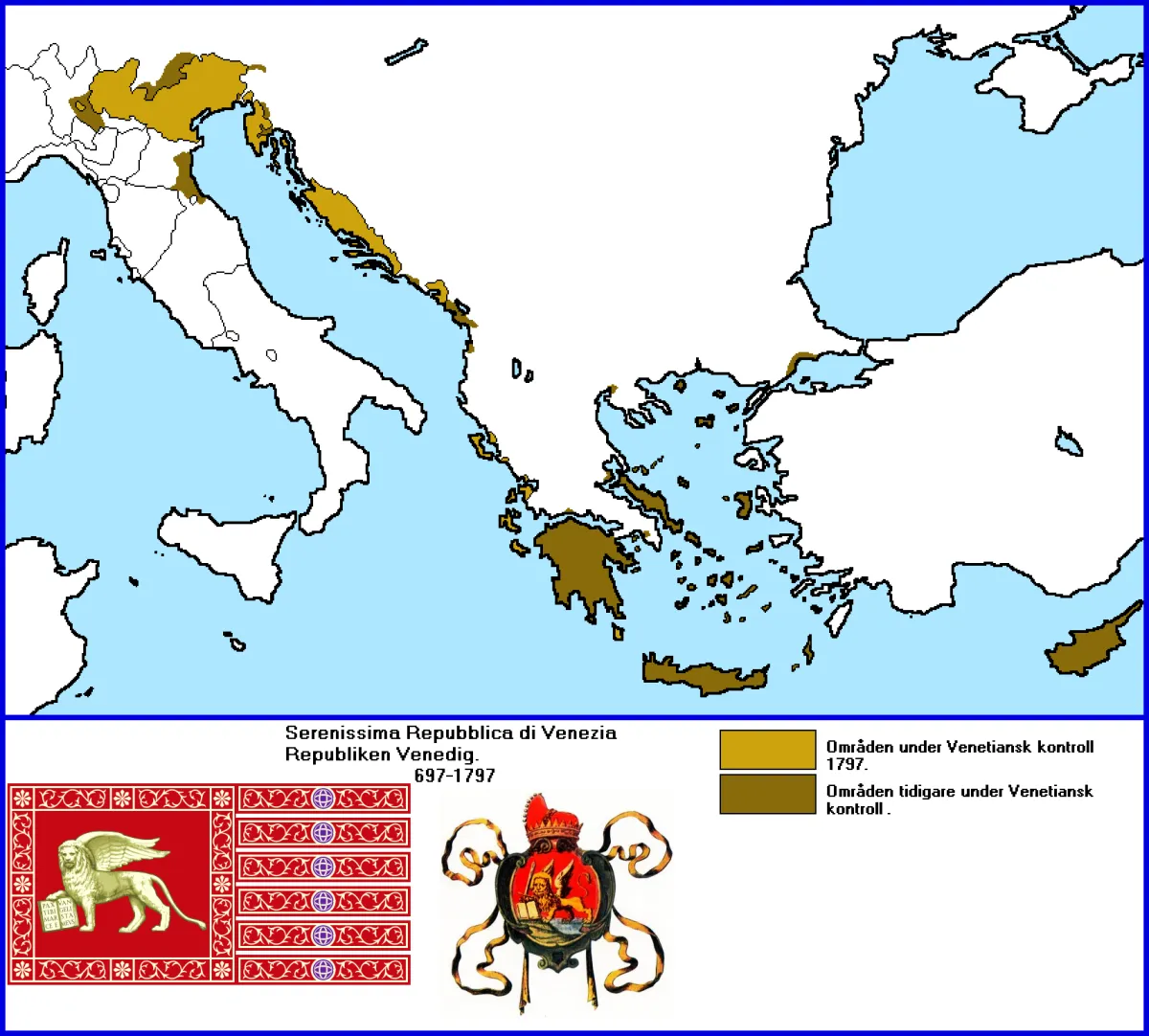 Photo: Republic of Venice, via orig01.deviantart.net
 Photo: Doge's Palace, via static.trip101.com
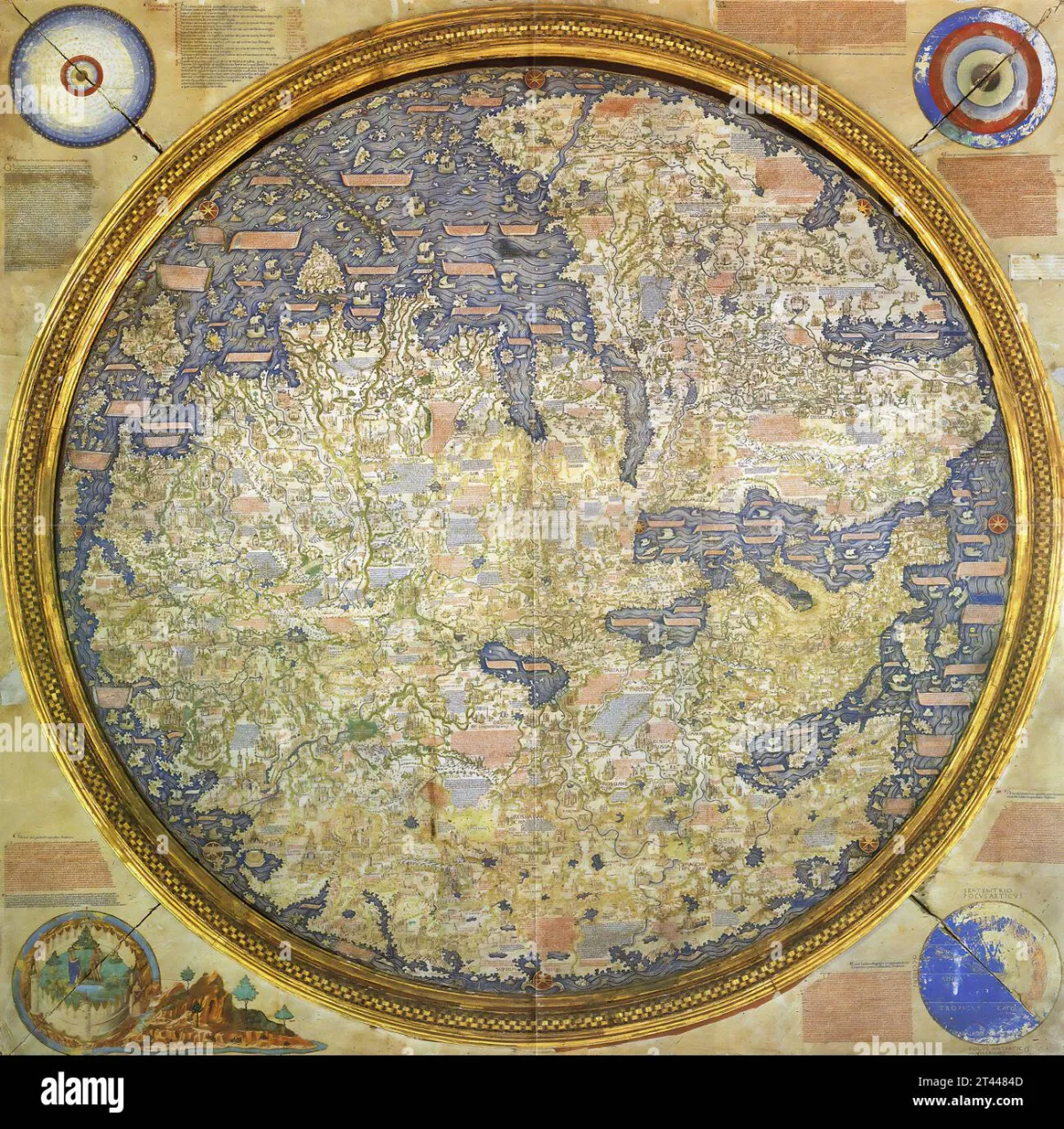 Photo: Fra Mauro, via c8.alamy.com
For five thousand years, accurate maps have functioned as state secrets, military weapons, and economic advantages. The democratization of geographic information through smartphone technology represents one of the most profound shifts in the distribution of power since the invention of writing.
The Ancient Monopoly of Place
Early civilizations treated geographic knowledge as sacred information. Egyptian priests controlled maps of Nile flood patterns that determined agricultural success. Mesopotamian kings guarded route information that enabled long-distance trade. Chinese emperors classified topographic surveys that revealed defensive positions and resource locations.
This secrecy served multiple functions. Accurate maps enabled efficient tax collection by revealing previously unknown settlements and resources. They provided military advantages by showing enemy territories, strategic chokepoints, and supply routes. Most importantly, they created economic monopolies by concealing profitable trade paths from competitors.
The Phoenicians built their maritime empire partly on geographic intelligence, carefully guarding knowledge of Atlantic routes while spreading false information about the dangers beyond the Mediterranean. Their deliberate cartographic deception maintained profitable monopolies for centuries.
The Weaponization of Wrong Maps
Deliberate geographic misinformation became a sophisticated tool of statecraft. Roman maps distributed to potential enemies contained systematic errors designed to confuse invasion routes and conceal strategic assets. Medieval European kingdoms routinely falsified border surveys to support territorial claims.
The most elaborate deception campaigns involved maritime charts. Portuguese navigators during the Age of Exploration created false maps showing imaginary islands and incorrect distances to prevent competitors from following their routes to Asian markets. Spanish treasure fleets used decoy charts showing fictional harbors to mislead pirates and rival nations.
These deception strategies worked because verifying geographic information required enormous resources and significant risks. A single incorrect map could doom an expedition, bankrupt a trading company, or expose an army to catastrophic defeat.
Venice and the Economics of Cartographic Control
The Venetian Republic perfected the economic exploitation of geographic intelligence. Their merchants possessed the most accurate charts of Eastern Mediterranean and Black Sea routes, information they protected through elaborate security measures. Map theft was punishable by death. Cartographers worked under guard and were forbidden to travel abroad.
This geographic monopoly generated immense wealth. Venetian traders could navigate efficiently while competitors struggled with inferior charts. They knew which ports offered the best prices, which routes avoided political instability, and which seasons provided optimal sailing conditions.
The system began failing when alternative information sources emerged. Ottoman expansion provided new geographic intelligence to Venice's rivals. Portuguese exploration opened Atlantic routes that bypassed Venetian-controlled territories. Most critically, printing technology made map reproduction easier and secrecy harder to maintain.
The Military Revolution of Accurate Terrain
Napoleonic warfare demonstrated how superior geographic intelligence could overcome numerical disadvantages. French forces carried detailed topographic maps while their enemies relied on sketchy local knowledge. This advantage enabled rapid movement, superior positioning, and coordinated attacks that consistently defeated larger armies.
The American Civil War saw the first systematic use of aerial reconnaissance for mapmaking. Union balloon observations provided detailed intelligence about Confederate positions and terrain features. This geographic advantage proved decisive in multiple campaigns, particularly around Richmond where accurate maps enabled complex flanking maneuvers.
World War I elevated geographic intelligence to industrial scale. Artillery effectiveness depended on precise coordinate systems. Trench warfare required detailed knowledge of elevation changes and soil conditions. Air reconnaissance generated geographic information at unprecedented speed and accuracy.
The Satellite Revolution and Democratic Maps
Cold War competition drove the greatest expansion of geographic intelligence in human history. Soviet and American satellite programs gathered detailed information about global terrain, resources, and infrastructure. This intelligence remained classified, maintaining traditional patterns of geographic secrecy.
The transformation began in the 1990s when the U.S. government released GPS technology for civilian use. Suddenly, precise location information became available to anyone with appropriate equipment. The launch of Google Earth in 2005 democratized satellite imagery that had previously been restricted to intelligence agencies.
Smartphone adoption completed the revolution. Today, detailed maps with real-time updates live in billions of pockets. Street-level imagery, traffic patterns, and business locations are freely accessible. The geographic information that once determined the fate of empires now guides routine trips to grocery stores.
The New Landscape of Geographic Power
This democratization hasn't eliminated geographic intelligence as a source of power—it has transformed how that power operates. Technology companies that control mapping platforms possess unprecedented knowledge of human movement patterns, economic activity, and social networks.
Google, Apple, and similar corporations can track traffic flows, predict demand patterns, and analyze social behavior on scales that would have amazed ancient emperors. This information enables targeted advertising, urban planning, and economic forecasting with remarkable precision.
Governments maintain advantages in specialized geographic intelligence. Military satellites provide higher resolution imagery than civilian services. Intelligence agencies possess real-time tracking capabilities that commercial platforms cannot match. Classified databases contain information about infrastructure vulnerabilities and strategic resources.
The Persistence of Geographic Secrets
Despite apparent democratization, significant geographic information remains restricted. Nuclear facility locations are censored from public maps. Military base details are deliberately obscured. Critical infrastructure maps are classified to prevent terrorist targeting.
China's approach illustrates how authoritarian governments maintain geographic control in the digital age. Chinese mapping services are required to use coordinate systems that introduce systematic errors. Foreign GPS devices often display incorrect locations within Chinese territory. The government treats accurate geographic information as a security asset requiring protection.
Implications for Modern Power Dynamics
The shift from scarce to abundant geographic information represents a fundamental change in how societies organize themselves. When maps were secret, power concentrated among those who controlled geographic knowledge. Today's abundance enables new forms of organization but creates different vulnerabilities.
Modern societies depend on GPS systems that remain under government control. Disruption of satellite navigation would cripple transportation, agriculture, and finance. This dependency creates new strategic vulnerabilities while eliminating old ones.
The lesson from five thousand years of cartographic history is clear: geographic information always serves power, whether concentrated or distributed. The question isn't whether maps will influence politics and economics, but how their current form will shape the distribution of advantage in an interconnected world.
Understanding this history provides context for contemporary debates about digital privacy, platform power, and information security. The ancient relationship between geographic knowledge and political dominance continues, but the players and rules have fundamentally changed.